| dc.contributor.author | Amaro-Mellado, José Lázaro | |
| dc.contributor.author | Tien Bui, Dieu | |
| dc.date.accessioned | 2021-04-07T12:23:43Z | |
| dc.date.available | 2021-04-07T12:23:43Z | |
| dc.date.created | 2020-07-17T18:59:07Z | |
| dc.date.issued | 2020 | |
| dc.identifier.citation | Amaro-Mellado, J. L., & Tien Bui, D. (2020). GIS-Based Mapping of Seismic Parameters for the Pyrenees. ISPRS International Journal of Geo-Information, 9(7). | en_US |
| dc.identifier.issn | 2220-9964 | |
| dc.identifier.uri | https://hdl.handle.net/11250/2736638 | |
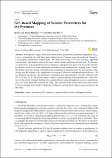
| dc.description.abstract | In the present paper, three of the main seismic parameters, maximum magnitude -Mmax, b-value, and annual rate -AR, have been studied for the Pyrenees range in southwest Europe by a Geographic Information System (GIS). The main aim of this work is to calculate, represent continuously, and analyze some of the most crucial seismic indicators for this belt. To this end, an updated and homogenized Poissonian earthquake catalog has been generated, where the National Geographic Institute of Spain earthquake catalog has been considered as a starting point. Herein, the details about the catalog compilation, the magnitude homogenization, the declustering of the catalog, and the analysis of the completeness, are exposed. When the catalog has been produced, a GIS tool has been used to drive the parameters’ calculations and representations properly. Different grids (0.5x0.5º and 1x1º) have been created to depict a continuous map of these parameters. The b-value and AR have been obtained that take into account different pairs of magnitude–year of completeness. Mmax has been discretely obtained (by cells). The analysis of the results shows that the Central Pyrenees (mainly from Arudy to Bagnères de Bigorre) present the most pronounced seismicity in the range. | en_US |
| dc.language.iso | eng | en_US |
| dc.relation.uri | https://www.mdpi.com/2220-9964/9/7/452 | |
| dc.rights | Navngivelse 4.0 Internasjonal | * |
| dc.rights.uri | http://creativecommons.org/licenses/by/4.0/deed.no | * |
| dc.title | GIS-Based Mapping of Seismic Parameters for the Pyrenees | en_US |
| dc.type | Peer reviewed | en_US |
| dc.type | Journal article | en_US |
| dc.description.version | publishedVersion | en_US |
| dc.rights.holder | © The Author(s). | en_US |
| dc.source.volume | 9 | en_US |
| dc.source.journal | ISPRS International Journal of Geo-Information | en_US |
| dc.source.issue | 7 | en_US |
| dc.identifier.doi | https://doi.org/10.3390/ijgi9070452 | |
| dc.identifier.cristin | 1819741 | |
| dc.source.articlenumber | 452 | en_US |
| cristin.ispublished | true | |
| cristin.fulltext | original | |
| cristin.qualitycode | 1 | |

