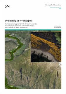
Evaluating in-riverscapes: Remote sensing green LiDAR efficiently provides accurate high-resolution bathymetric maps, but is limited by water penetration
| dc.contributor.author | Kastdalen, Leif | |
| dc.contributor.author | Heggenes, Jan | |
| dc.coverage.spatial | Bø | en_US |
| dc.coverage.spatial | Hallingdal | |
| dc.coverage.spatial | Lærdal | |
| dc.date.accessioned | 2023-02-10T08:35:13Z | |
| dc.date.available | 2023-02-10T08:35:13Z | |
| dc.date.issued | 2023 | |
| dc.identifier.isbn | 978-82-7206-744-0 | |
| dc.identifier.issn | 2535-5325 | |
| dc.identifier.uri | https://hdl.handle.net/11250/3049896 | |
| dc.description.abstract | This report investigates the feasibility of using Airborne green LiDAR Bathymetry to map the topography of in-riverscapes. First, the accuracy of remote sensing green LiDAR data are compared with the alternative in situ methods of traditional stratified transect point sampling and MultiBeam bathymetry. Secondly, the factors potentially limiting the feasibility of green LIDAR in rivers, i.e., factors explaining the loss of/lack of green LiDAR data, are explored. Thirdly, three types of green LiDAR sensors with different specifications are compared. Relatively long and variable within-river reaches (4 km or more) were studied to explore data robustness across different hydraulic patterns and water depths. If signals were reflected, the different sensors generally provided remote sensing elevation data consistent with in situ elevation measurements, indicating high accuracy (±10 cm) across different hydraulic conditions. Loss of green LiDAR data was mainly a consequence of limited signal water penetration capability, i.e., the main environmental factor was water clarity. Secchi depth was a close proxy variable associated with green LiDAR penetration capability across rivers. Data loss was low until around Secchi water depth but increased rapidly thereafter. Surface water turbulence (‘white water’) and dark riverbed vegetation also increased green LiDAR signal loss. Point density and water penetration capabilities varied across sensors. Sensors with lower point density and thereby less spatial resolution, also had more signal strength and therefore penetrated deeper water. We conclude that green LiDAR bathymetry overall is a robust method that efficiently provides accurate elevation data across different hydraulic conditions and water depths. The main concern is signal loss, which is associated with Secchi water depth, and aggravated by surface turbulence (‘white water’) and dark coloured riverbed. Technically, this loss also depends on green LiDAR signal power, which vary across sensors. Therefore, signal power should be balanced with signal density (spatial resolution), depending on project objectives. | en_US |
| dc.language.iso | eng | en_US |
| dc.publisher | University of South-Eastern Norway | en_US |
| dc.relation.ispartofseries | Publication series from University of South-Eastern Norway;112 | |
| dc.rights.uri | https://creativecommons.org/licenses/by-nc-sa/4.0/ | |
| dc.title | Evaluating in-riverscapes: Remote sensing green LiDAR efficiently provides accurate high-resolution bathymetric maps, but is limited by water penetration | en_US |
| dc.type | Report | en_US |
| dc.description.version | publishedVersion | en_US |
| dc.rights.holder | © The Authors | en_US |
Files in this item
This item appears in the following Collection(s)
-
Skriftserien fra Universitetet i Sørøst-Norge [175]
Publication Series from University of South-Eastern Norway

Except where otherwise noted, this item's license is described as https://creativecommons.org/licenses/by-nc-sa/4.0/