Novel Hybrid Swarm Optimized Multilayer Neural Network for Spatial Prediction of Flash Flood at Tropical Area Using Sentinel-1 SAR Imagery and Geospatial data
| dc.contributor.author | Phuong-Thao Thi, Ngo | |
| dc.contributor.author | Hoang, Nhat-Duc | |
| dc.contributor.author | Biswajeet, Pradhan | |
| dc.contributor.author | Quang Khanh, Nguyen | |
| dc.contributor.author | Xuan Truong, Tran | |
| dc.contributor.author | Quang Minh, Nguyen | |
| dc.contributor.author | Viet Nghia, Nguyen | |
| dc.contributor.author | Pijush, Samui | |
| dc.contributor.author | Tien Bui, Dieu | |
| dc.date.accessioned | 2019-01-30T06:53:08Z | |
| dc.date.available | 2019-01-30T06:53:08Z | |
| dc.date.created | 2018-10-16T11:00:46Z | |
| dc.date.issued | 2018 | |
| dc.identifier.citation | Sensors. 2018, 18 (11). | nb_NO |
| dc.identifier.issn | 1424-8220 | |
| dc.identifier.uri | http://hdl.handle.net/11250/2582957 | |
| dc.description | This article is an open access article distributed under the terms and conditions of the Creative Commons Attribution (CC BY) license | nb_NO |
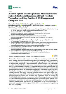
| dc.description.abstract | Flash floods are widely recognized as one of the most devastating natural hazards in the world, therefore prediction of flash flood-prone areas is crucial for public safety and emergency management. This research proposes a new methodology for spatial prediction of flash floods based on Sentinel-1 SAR imagery and a new hybrid machine learning technique. The SAR imagery is used to detect flash flood inundation areas, whereas the new machine learning technique, which is a hybrid of the firefly algorithm (FA), Levenberg–Marquardt (LM) backpropagation, and an artificial neural network (named as FA-LM-ANN), was used to construct the prediction model. The Bac Ha Bao Yen (BHBY) area in the northwestern region of Vietnam was used as a case study. Accordingly, a Geographical Information System (GIS) database was constructed using 12 input variables (elevation, slope, aspect, curvature, topographic wetness index, stream power index, toposhade, stream density, rainfall, normalized difference vegetation index, soil type, and lithology) and subsequently the output of flood inundation areas was mapped. Using the database and FA-LM-ANN, the flash flood model was trained and verified. The model performance was validated via various performance metrics including the classification accuracy rate, the area under the curve, precision, and recall. Then, the flash flood model that produced the highest performance was compared with benchmarks, indicating that the combination of FA and LM backpropagation is proven to be very effective and the proposed FA-LM-ANN is a new and useful tool for predicting flash flood susceptibility | nb_NO |
| dc.description.abstract | Novel Hybrid Swarm Optimized Multilayer Neural Network for Spatial Prediction of Flash Flood at Tropical Area Using Sentinel-1 SAR Imagery and Geospatial data | nb_NO |
| dc.language.iso | eng | nb_NO |
| dc.rights | Navngivelse 4.0 Internasjonal | * |
| dc.rights.uri | http://creativecommons.org/licenses/by/4.0/deed.no | * |
| dc.title | Novel Hybrid Swarm Optimized Multilayer Neural Network for Spatial Prediction of Flash Flood at Tropical Area Using Sentinel-1 SAR Imagery and Geospatial data | nb_NO |
| dc.type | Journal article | nb_NO |
| dc.type | Peer reviewed | nb_NO |
| dc.description.version | publishedVersion | nb_NO |
| dc.rights.holder | © 2018 by the authors. Licensee MDPI, Basel, Switzerland. | nb_NO |
| dc.source.pagenumber | 26 | nb_NO |
| dc.source.volume | 18 | nb_NO |
| dc.source.journal | Sensors | nb_NO |
| dc.source.issue | 11 | nb_NO |
| dc.identifier.doi | 10.3390/s18113704 | |
| dc.identifier.cristin | 1620733 | |
| cristin.unitcode | 222,57,1,0 | |
| cristin.unitname | Institutt for økonomi og IT | |
| cristin.ispublished | true | |
| cristin.fulltext | original | |
| cristin.qualitycode | 1 |
Tilhørende fil(er)
Denne innførselen finnes i følgende samling(er)
-
Institutt for økonomi og it [152]
-
Publikasjoner fra CRIStin [3416]

